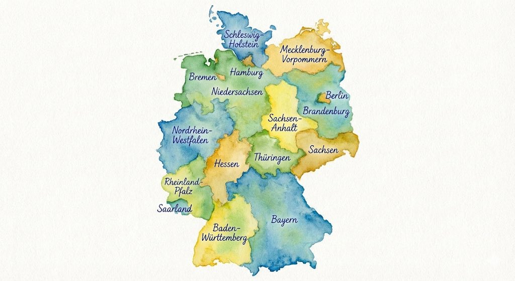
Watercolor Map of Germany With Labeled States
A German prompt to generate a watercolor-style map of Germany where all federal states are labeled in ballpoint pen, useful for educational or infographic-style maps.
Example Images
Edit Your Prompt
Replace placeholders like {{YOUR_NAME}} or {{SUBJECT}} with your own values
Add Reference Images (Optional, up to 5)
Click to upload, or press ⌘V / Ctrl+V to paste from clipboard
Add reference images to guide the AI generation
Aspect Ratio
Select AI Model
Fast and affordable standard quality AI images.
Premium quality, more realistic and detailed results.
Tags
This Watercolor Map of Germany With Labeled States prompt is built to produce consistent, high-quality images. Adjust the wording to your taste, choose an aspect ratio, and let the AI handle the rest.
What is the Watercolor Map of Germany With Labeled States prompt?
Think of the watercolor map of germany with labeled states prompt as a recipe for the image you want. Each phrase nudges the model toward a particular look, and you can change any ingredient — the subject, the setting, the style — to make it your own.
How to use the Watercolor Map of Germany With Labeled States prompt
- 1Copy the Watercolor Map of Germany With Labeled States prompt using the copy button
- 2Replace any placeholders (like {{SUBJECT}}) with your own details
- 3Pick an aspect ratio and optionally add reference images
- 4Hit generate and download your result
Tips for better results
- Regenerate a few times — small variations between runs are normal
- Use aspect ratio to match where you'll post: square for feed, 9:16 for stories
- Remove placeholders like {{SUBJECT}} before generating, or the model may render them literally
- Try the PRO model for more realistic, detailed output on complex scenes